Vetting the Route
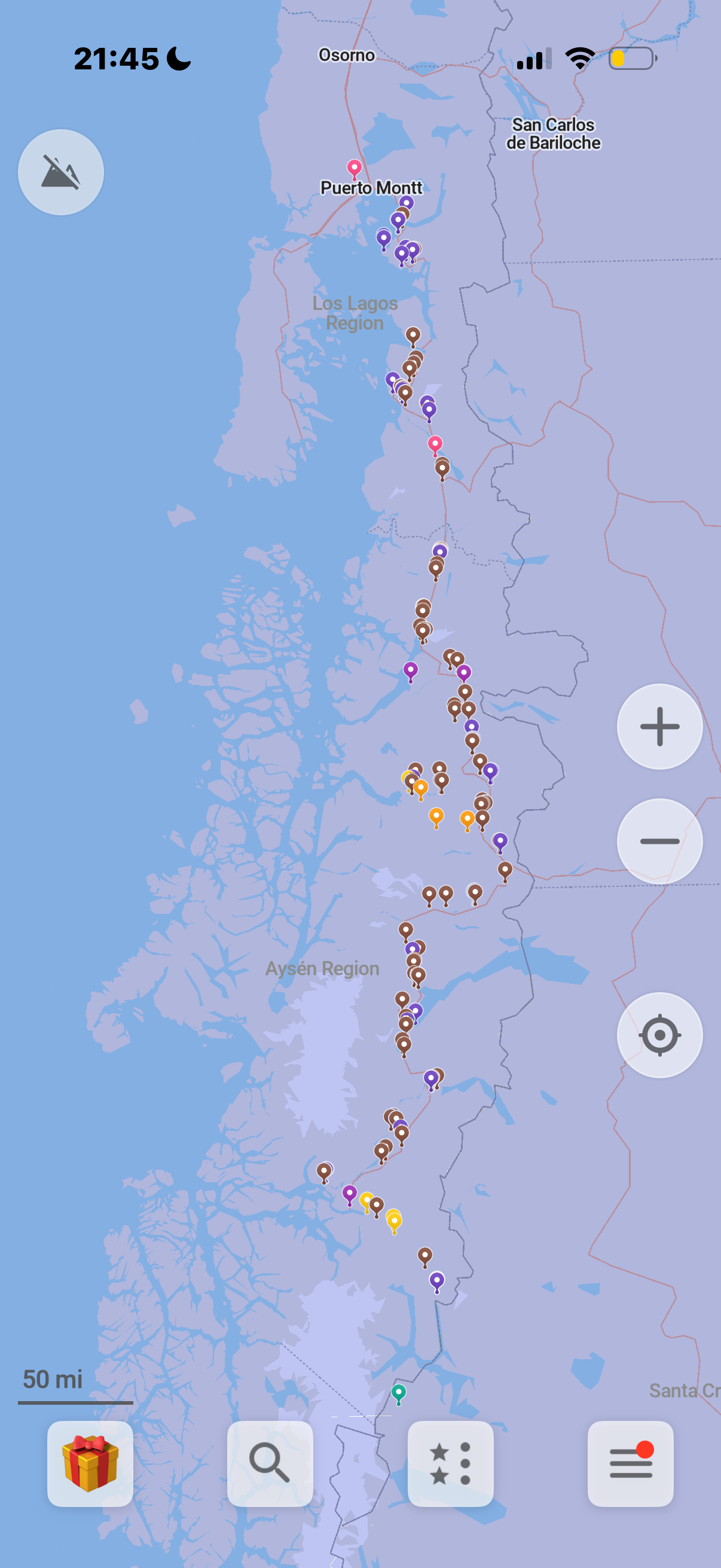
Our actual pins on Organic maps
Next, we needed to figure out what we’d actually be dealing with on a day-to-day basis.
That meant going through the entire route—town by town—to understand distances, food availability, and what camping might realistically look like. Luckily, it’s 2025, and there are a few apps that make this kind of planning possible.
So Shaun and I split the work.
Shaun took on food logistics. He went through the route in detail, checking where there might be restaurants, small markets, or something resembling a grocery store. And none of this was guaranteed. When something is labeled a “supermarket” down there, it can sometimes mean a single room with a few shelves and very limited options.
Very different from the U.S., where we’re used to endless aisles of non-expiring, high-sugar snacks.
We had no idea what we’d actually find—so we planned accordingly. Food is food, right? We even packed an old-school can opener just in case canned goods were our only option. We also planned to carry multiple days’ worth of food at all times, because what happens if a delivery truck doesn’t make it to a tiny town? Or there’s just… nothing?
Worst case, we’d rely on each other—or the kindness of locals.
Meanwhile, I focused on camping.
I used a mix of apps to look for dispersed camping, but I also spent a lot of time researching paid camp spots as backups—places where we could shower, recharge, and feel vaguely human again. And this is where things really started to feel different from home.
In Idaho, camping is easy. There’s so much public land that you barely have to think about it. Dispersed camping is everywhere, and finding a spot is almost a given.
Patagonia is not like that.
From what I found, there is a fair share of dispersed camping but out of the paid camping about 98% of the campgrounds along the route are on private land. You basically roll up to someone’s property and ask if you can stay the night. Most have designated camping areas in their yard, with bathrooms, showers, and sometimes even outlets for charging electronics. If they don’t, it sounds like many are so hospitable that they’ll invite you inside if you really need it.
A lot of these places also sell fresh bread, jam, or handmade crafts to passersby. None of them are official. No websites. No booking platforms. Just Google reviews, word of mouth, and often a WhatsApp number if you have questions.
The idea of rolling up to someone’s land, speaking broken, non-existent Spanish, and asking to camp in their backyard definitely feels like a culture shock. But everything I read made it sound like people would welcome us with open arms.
All of the places we vetted got saved into Organic Maps, which works offline. We pinned food stops in one color and camping in another. I even added phone numbers and notes about each place so we could quickly decide what made sense when we were tired, hungry, or completely without service.
It took a long time—but I think it’ll be worth it.
I also mapped out mileage and elevation between towns using Strava. Early in the route, we wouldn’t go a day without passing through a small town. But farther south, towns get more spread out. Eventually, it could be a full day—or more—without seeing much of anything.
And honestly, that’s part of what I am most excited about. The vibe checks. The quiet stretches. The simplicity.
And if we somehow find our Chilean grandma or grandpa along the way? Even better.